Better Maps, Socially
Download free maps curated by the Genesis community.
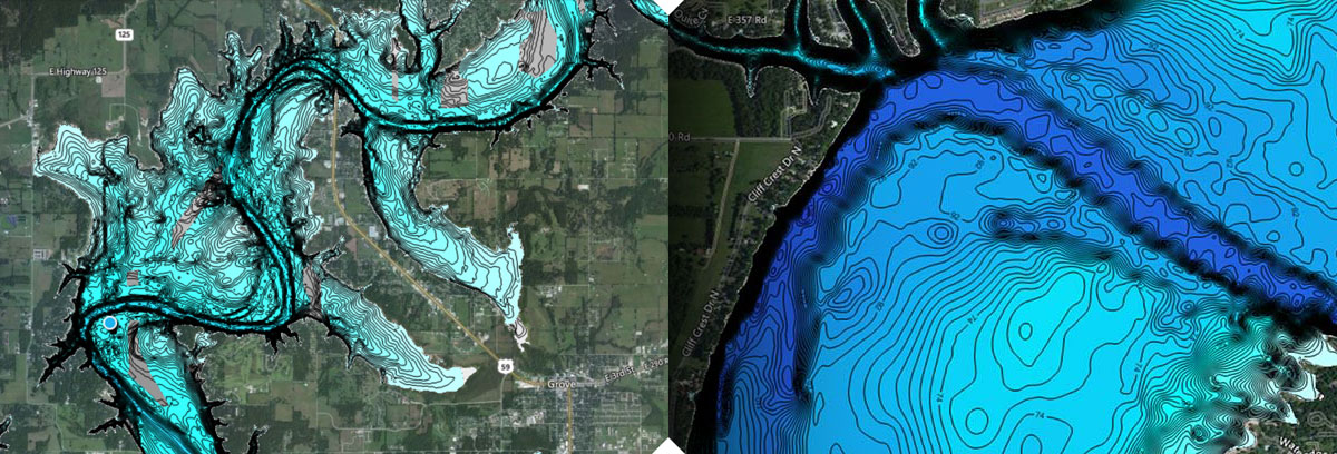
Social Mapping
Social Map is a free, global, online collection of inland and coastal C-MAP Genesis charts generated by the Lowrance, Simrad Yachting and B&G communities of fishing, cruising, and sailing enthusiasts. Anyone with a GoFree account can download free Social Map charts to an SD card for use on the water in a compatible chartplotter.
To make the best maps, only (non-private) trips that meet the high standards of the GIS professionals on our Quality Control team are included in Social Map .
Blue water drops represent locations where sonar data has been voluntarily contributed by C-MAP Genesis users. Sonar data marked “private” is not aggregated in Social Map . To see free maps in your areas of interest, click on a spot near a waterbody and zoom in using your mouse or the buttons located in the upper right hand of the map.
Blue-shaded depth contours in Social Map were community-sourced by Genesis users; gray-shaded contours represent legacy base-map data. If you would like to download a free Social Map chart to an SD card to use on the water in a compatible Lowrance, Simard Yachting or B&G sonar/GPS chartplotter, click on the download button and follow the prompts.
Check back frequently to see what new maps are available.
Click Here to View Social Map